How a powerful bomb cyclone ravaged the Northwest
Posted on 11/21/2024

This storm was off the charts.
The bomb cyclone emerged from the middle of the Pacific Ocean and swirled with such intensity off Washington’s coast that it ravaged the region Tuesday night, ripping down trees, toppling power lines and killing at least two.
Each storm like this is unique — with its own personality, said Lynn McMurdie, a professor of atmospheric sciences at the University of Washington.
“And this one has a lot of personality,” she said.
Pressure dropped 27 millibars in six hours, about four times faster than the rate meteorologists use to label storms as bomb cyclones. It dropped so far and so fast that, under one method of analysis, it landed in a category reserved for the strongest of its kind: A “super explosive cyclone.”
Bomb cyclones are common enough but rarely form as far south as this one did and gather so much strength so quickly, said Jason Ahsenmacher, lead meteorologist for the National Weather Service in Fairbanks.
As far back as the records go, a cyclone this strong hasn’t formed before in this part of the world at this time of year, Ahsenmacher said. It belongs to an upper echelon of low-pressure systems.
After it began to form, the cyclone loosely tracked the Pacific jet stream. Counterclockwise it churned, heading toward the coast, building strength along the way.
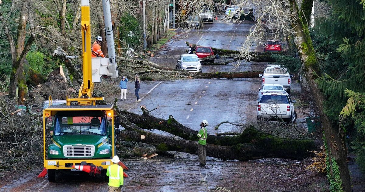
Air over Western Washington rushed toward that low-pressure trough, generating wind gusts of up to 74 mph in places. Hundreds of thousands of people lost power, marking Seattle’s most severe outage since 2006, while two died in the maelstrom. A woman was killed by a falling tree at a Lynnwood homeless encampment, and another woman was killed by a tree that smashed into her Bellevue home.
A characteristic that made this particular storm so damaging was the direction of the winds, east to west, said Karin Bumbaco, deputy state climatologist. Usually, Washington’s strongest winds come from the south or the southwest.
For trees, that makes a difference.
Think of a house plant, growing so its leaves or vines win the best exposure to sunlight. Similarly, trees can grow so their trunks, limbs and even roots resist strong winds from a particular direction, said Ray Larson, curator for the University of Washington’s Arboretum.
So heavy gusts blowing from the east, especially such strong winds, hit trees across the region at a weak angle, causing them to crack, fall and splinter, Larson said.
Utility and road crews across the region scrambled to clear the wreckage through Wednesday, and outages could stretch on for days.
As strong as this storm was — and it was a “really, really strong storm” — Washington avoided the worst of it because the system never made landfall, said Kirby Cook, science and operations officer for the National Weather Service in Seattle.
On Wednesday, the cyclone remained hundreds of miles off the coast where it began to dissipate. But a second storm will soon follow a similar path while the first diminishes, Cook said. They’ll almost orbit each other over the Pacific.
In tropical regions, the warming atmosphere (fueled by climate change) means the air can hold more water, leading to larger and stronger hurricanes. But Bumbaco doesn’t see the fingerprints of climate change in this bomb cyclone. These types of storms are common enough, and this just happened to be a strong one.
“It was more of an unlucky deal of the weather cards,” she said.
The incoming storm appears likely to form into another bomb cyclone, Ahsenmacher said. And while it likely also won’t make landfall, it could blow closer to the coast, which could once more bring strong winds.
Trees or branches weakened by the first storm might not survive the second, Larson said. Especially if more rain falls, softening the ground. People should keep a close eye on any foliage that might be at risk, move their cars inside garages whenever possible and try to avoid any unnecessary risks, he said.
Meteorologists will track the development of the new storm over the coming days.
Comments( 0 )
0 0 950
0 0 388
0 0 989
0 0 825


