West Coast bracing for 'bomb' cyclone
Posted on 11/18/2024

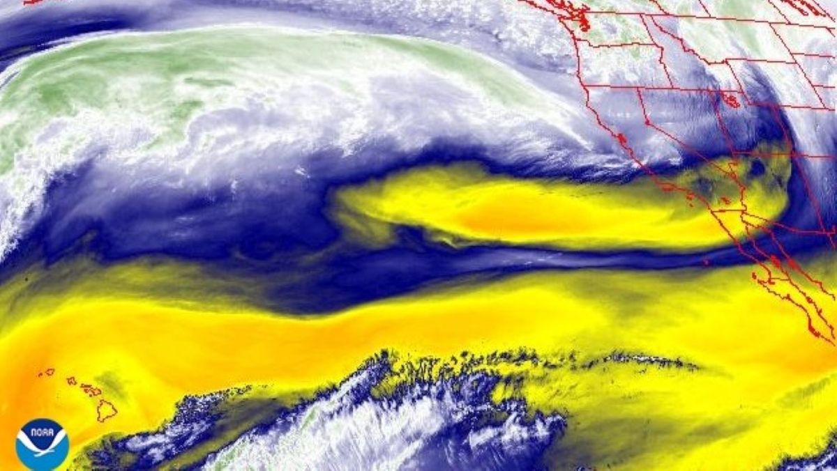
A likely "bomb cyclone" headed toward California and Oregon will bring high winds and heavy rains to the West Coast Tuesday (Nov. 19) through Thursday (Nov. 21).
According to WeatherNation, the storm system is forecasted to go through a rapid pressure drop from over 1,000 millibars of pressure on Monday (Nov. 18) night to less than 950 mb on Tuesday night.
A drop of more than 24 mb in 24 hours at these latitudes is known as "bombogenesis," transforming a storm into a so-called bomb cyclone, according to the National Oceanic and Atmospheric Administration (NOAA).
Bomb cyclones happen when warm and cold air masses collide. They undergo rapid intensification as their pressure drops. The low-pressure zone is expected to bring an atmospheric river to Northern California and southern Oregon, pulling moisture from the tropics northward.
The heaviest impacts, classified by the University of California, San Diego as "extreme," will be between the San Francisco Bay area and Eureka, California, according to WeatherNation. Strong impacts from the storm are expected as far north as central Oregon and as far south as Salinas, California. These include high winds, heavy rain, and the potential for flash flooding.
Gusts of wind may reach 70 mph (113 km/hour) in exposed areas, and rain could fall at a rate of 2 to 4 inches a day (5 to 10 centimeters), according to Fox Weather. Mountains of over 3,500 feet (1,067 meters) elevation could get up to 2 feet (0.6 m) of snow.
Atmospheric rivers threaten both property and lives, but they also bring much-needed water to the West Coast. According to NOAA, 30% to 50% of annual precipitation in West Coast states comes via a handful of atmospheric river events each year.
Comments( 0 )
0 0 948
0 0 387
0 0 988
0 0 825


