More Snow Coming to NY This Week: Over 5 Feet in Some Towns – See the Full Snowfall Breakdown
Posted on 12/03/2024

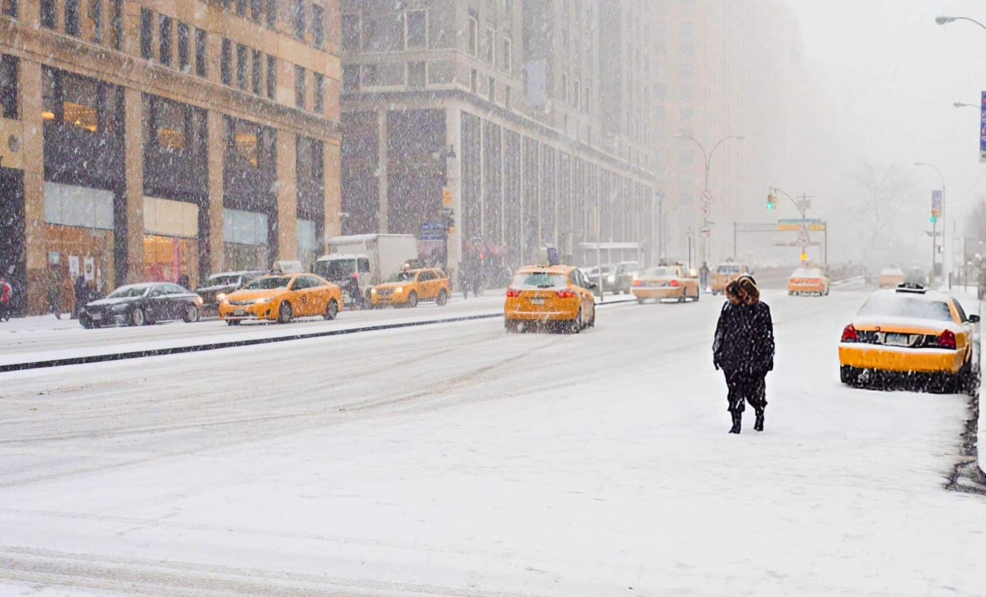
Winter storms have already had a major influence all throughout New York State as December settles in. Upstate New York has been hit with some of the heaviest snowfall on record, while New York City faces a more uncertain forecast for the upcoming days. Here’s a breakdown of snowfall totals across the state, as well as what to expect for the rest of the week.
Heavy Snowfall in Upstate New York
Over the weekend, lake-effect snow pummeled much of Upstate New York, bringing several feet of snow to areas east of Lake Erie and Lake Ontario. The most significant snowfalls were reported in Copenhagen, where 65.9 inches of snow accumulated, and Barnes Corners, which recorded 65.5 inches. Other areas, like Cassadaga and Chautauqua County, saw similar totals, including 54.1 inches in Cassadaga and 47 inches in Cherry Valley.
Snowfall totals in upstate New York:
Copenhagen: 65.9 inches (1.67 m)
Barnes Corners (Lewis County): 65.5 inches (1.66 m)
Cassadaga: 54.1 inches (1.37 m)
Chautauqua County: 47 inches (1.19 m)
Cherry Valley: 47 inches (1.19 m)
This region has long been prone to intense snowstorms due to its proximity to the Great Lakes, where lake-effect snow can rapidly accumulate. As of Monday, winter storm warnings remain in effect across Madison, Onondaga, Oswego, Cattaraugus, and Chautauqua counties, with ongoing snowfall expected to add another 12 to 20 inches (50.8 cm) in the hardest-hit areas. Local authorities have urged caution, as roads have been heavily impacted by drifting snow and reduced visibility.
Additionally, the northwest corner of the state received warnings for flooding, as the heavy snow and subsequent melt could overwhelm the region’s drainage systems. Temperatures in the region have stayed in the 20s to low 30s, meaning the snow has remained relatively heavy and wet.
Snowfall totals for 122 Upstate communities
Here are the snowfall totals for the weekend lake effect storm as of Monday, December 2, 2024. Note: Updated with more communities.
What’s Next for Upstate New York?
More snow is on the way for upstate New York, with Rochester, Syracuse, and Buffalo preparing for additional lake-effect snow starting Tuesday and continuing through Wednesday. Chautauqua and Cattaraugus counties remain the most vulnerable, where forecasters predict up to 20 inches (50.8 cm) of new snow. The heaviest snow bands are expected to push eastward, affecting areas like Madison County and Syracuse, where up to 10 inches (25.4 cm) could accumulate by the evening.
Beyond this, there is still a chance of snow today, and although conditions may ease by the end of the week, snowfall totals could surpass 5 feet (1.52 metres) in the hardest-hit regions by the time the storm system moves out. Snow removal and power outages could remain a concern for rural areas.
New York City’s Winter Outlook
As for New York City, the first significant snowfall of the season remains up in the air. Meteorologists are predicting an Alberta Clipper system, expected to move through the region late in the week. While New York City is on the fringe of the storm, the city may only see light snow, as temperatures are forecasted to hover around the low 40s. Snow accumulations in the city are predicted to be relatively minimal, with some flurries likely on Saturday.
Though the Alberta Clipper is not expected to bring major snow, it will still deliver some chilly weather and could cause delays for commuters, especially with the wind chill. In fact, forecasters have predicted that 20 inches of snow is expected for the entire winter season in NYC, slightly below the usual average of 28 inches.
Broader Winter Forecast for NYC
Despite the expected lighter snowfall, New York City can anticipate a milder-than-usual winter overall. Temperatures are predicted to remain above average for the next few months. Long-range models suggest that January and February could see more rainy days than snowy ones, with mixed precipitation events being the most likely cause of winter disruptions. In general, snowfall totals are expected to remain below the historical average, with projections estimating about 18–23 inches of snow by the end of the season.
For the outer boroughs of Queens and Brooklyn, even lighter snow totals are anticipated. Historically, these areas have seen less snowfall than parts of Manhattan or The Bronx, and this winter may follow that trend.
Impact on Local Infrastructure and Commuting
The immediate concern remains the impact on transportation across both upstate New York and New York City. In upstate regions, the heavy snow is expected to disrupt travel across counties like Onondaga, Cattaraugus, and Madison, where Interstate 81 and Route 390 are notorious for becoming hazardous during heavy snow events. Some local roads in Syracuse and Rochester may remain impassable for several days, and power outages have been reported in more remote areas due to downed power lines.
Comments( 0 )
0 0 3
0 0 1


