Bomb cyclone kills 2, knocks out power in Washington and Seattle as a new threat arrives for the West Coast
Posted on 11/20/2024

A historically strong bomb cyclone killed at least two people and caused a mass power outage that could last for days after it slammed the Pacific Northwest and Canada’s British Columbia with destructive winds.
Now a new threat from the storm is emerging Wednesday as its winds wind down: It’s combining with an atmospheric river to unleash life-threatening flooding rainfall over parts of the West Coast that will continue for the rest of the week.
More than 500,000 homes and businesses were without power early Wednesday morning in Washington after hurricane-force winds bludgeoned the state’s energy infrastructure Tuesday, according to PowerOutage.us. Nearly 100,000 customers were without power in British Columbia, BC Hydro reported on its website.
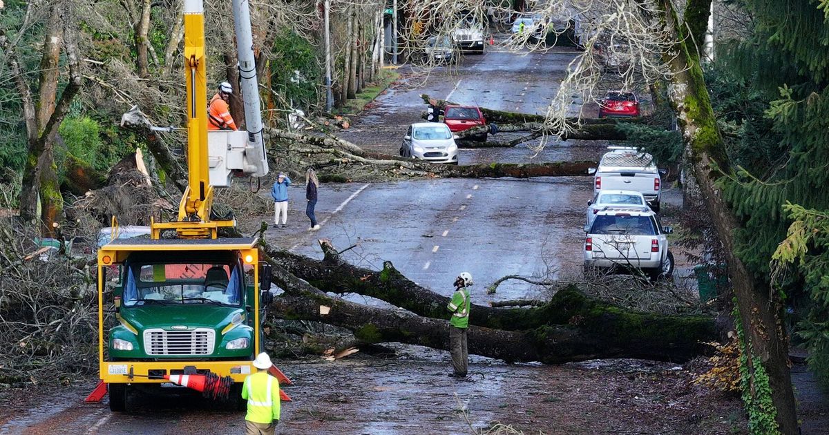
Hurricane-force wind gusts up to 77 mph wreaked havoc in the western part of the state, bringing down numerous trees in addition to power lines. The Seattle area was particularly hard-hit. Puget Sound Energy, which services the area, said more than 450,000 customers lost power in a “mass outage event” that could last “multiple days.”
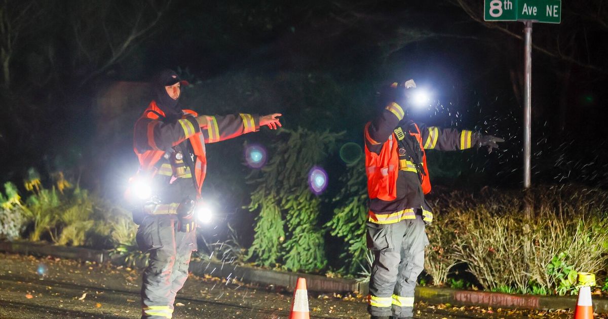
“It’s severe out there. Trees are coming down all over the city, with multiple falling onto homes,” the fire department in Bellevue, east of Seattle, warned on social media Tuesday.
One of those trees killed a woman showering in her King County home, the Bellevue Fire Department confirmed Wednesday. The victim’s husband was removed from the home for his own safety.
A second woman, who was in her 50s, was killed around the same time in Lynnwood, north of Seattle, when a large tree fell on a homeless encampment shortly after 7 p.m. Tuesday, South County Fire Department told CNN.
Southeast of Seattle, two people in Maple Valley were rescued and taken to a nearby hospital after a tree fell on their trailer. While one person was freed quickly, it took firefighters an hour to extricate the second, according to Puget Sound Fire.
A tree slammed into Washington resident Rob Corcoran’s home Tuesday evening and when it did, he told CNN it sounded like a jet landing on his roof.
“I didn’t even go outside because I was scared I could be hit with flying debris,” Corcoran said. “I had no idea it was as bad as it is.”
An Amtrak train collided with a fallen tree north of Seattle in Stanwood, Tuesday night, according to CNN affiliate KIRO. The incident left the train inoperable, though none of the 47 passengers on board were injured, KIRO reported. CNN reached out to Amtrak for more information.
A once-in-a-decade storm
The storm rapidly intensified Monday night into Tuesday in a phenomenon called “bombogenesis” and earned it the meteorological moniker of “bomb cyclone.”
Bomb cyclones are formidable and unload heavy snow and strong winds during the winter.
This one was tied for the most-intense on record for its location, a storm so strong that it occurs only “about once every ten years,” the National Weather Service in Medford, Oregon, said Tuesday. It more than doubled the criteria needed to be designated a bomb cyclone from Monday night to Tuesday night.
The powerful cyclone unleashed widespread wind gusts of 60 to nearly 80 mph through western Washington while even stronger winds up to 101 mph roared just off the coast, according to the National Weather Service in Seattle.
Gusts up to 60 mph slammed western Oregon and Northern California endured gusts up to 80 mph.
Winds will remain strong at times through at least early Wednesday before gradually starting to ease to gusty, but less damaging levels. But the region’s weather threat is far from over.
Another bomb cyclone?
Rain soaking Northern California and parts of the Pacific Northwest early Wednesday will get heavier throughout the day as an atmospheric river strengthens and ultimately peaks in intensity on Thursday.
An atmospheric river is a firehose of moisture that, when tapped by a storm like the bomb cyclone, often deluges those in its path with torrential rain, sometimes lasting for days.
That’s what will happen this week, so a level 3 of 4 risk of flooding rainfall is in place for parts of Northern California Wednesday, according to the Weather Prediction Center. That risk level climbs to a rare level 4 of 4 high risk on Thursday.
“Flash flooding will be an increasing risk, with the potential for some life-threatening situations,” the weather service in Eureka, California, warned late Tuesday.
Parts of northwestern California could record 16 inches of rain or more in 48 hours. More than a month’s worth of rain is expected in the northern San Francisco Bay area, primarily north of the Golden Gate Bridge, the weather service there said. Rainfall of this magnitude is expected to cause significant urban flooding, debris flow on roadways and river flooding.
Heavy rain will persist for parts of Northern California through Friday as the soaking weather gets a fresh jolt of atmospheric energy from a new storm to keep it churning.
Another bomb cyclone could develop and rapidly strengthen just off the West Coast on Friday. This new storm will likely be weaker than the first, but will still juice up the region’s rain threat and could also usher in another round of damaging winds.
CNN’s Isaac Yee, Sara Smart, Andy Rose and Mike Madrigal contributed to this report.
Comments( 0 )
0 0 0
0 0 2


