Atmospheric river in California: Where will extreme impacts land?
Posted on 11/19/2024

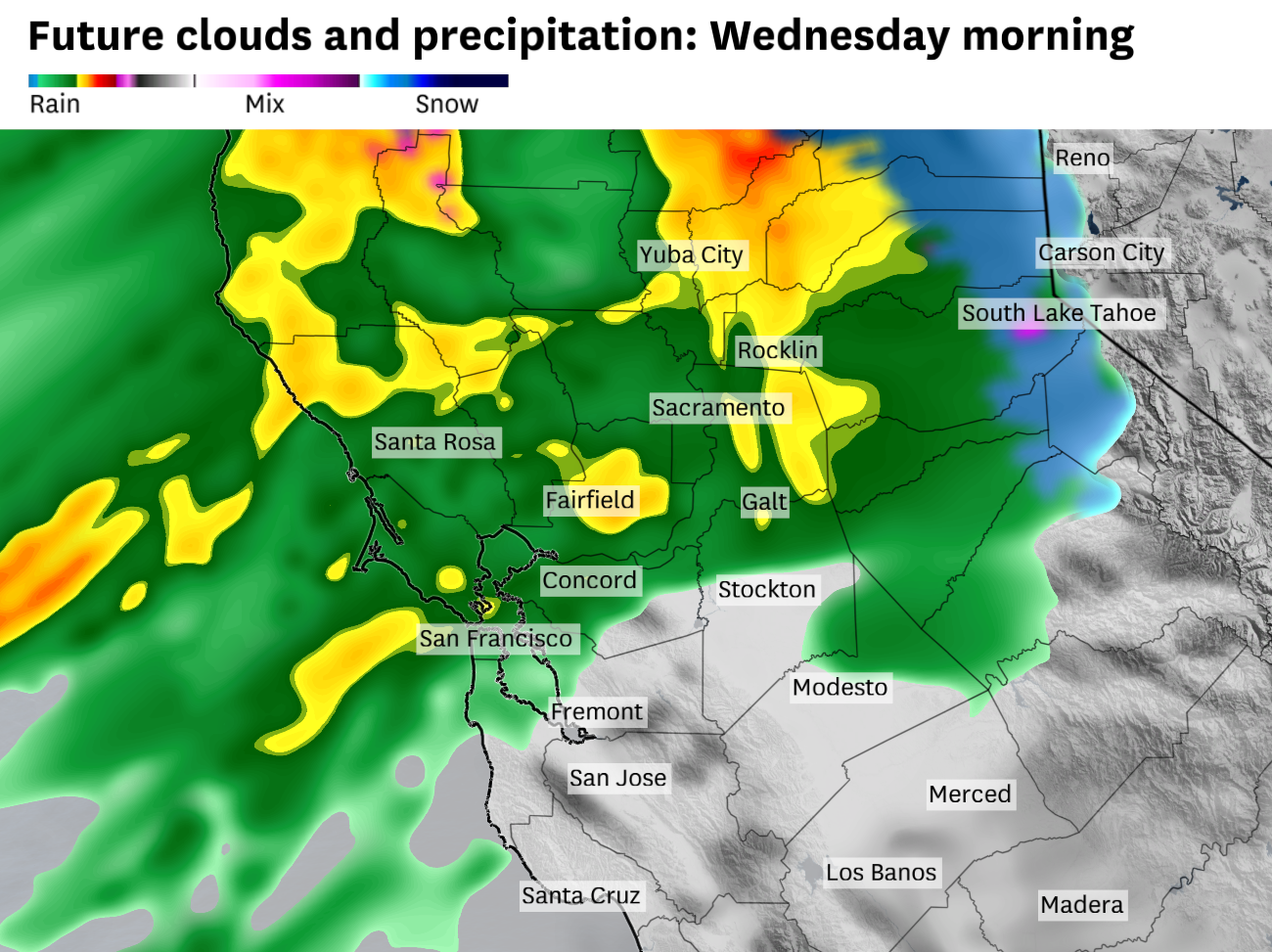
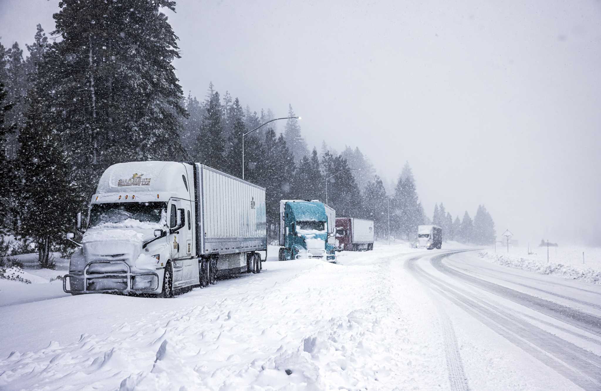
An extremely strong atmospheric event is in the forecast, with flood watches and blizzard warnings across Northern California. But the precipitation forecast around the Bay Area is much less certain.
Rainfall begins early Wednesday morning, and here’s how a boom-or-bust precipitation scenario could play out in the Bay Area.
Advertisement
Article continues below this ad
How a boom scenario could happen for the Bay Area
Forecast rainfall totals Wednesday through Friday
4 to more than 8 inches in the North Bay
2 to 4 inches for San Francisco and East Bay
1 to 2 inches in Santa Cruz and the South Bay
The key to these totals lies, unsurprisingly, in the positioning of the atmospheric river plume. However, it’s not the only factor driving a potential boom scenario. Two key periods will determine just how much rain the region receives.
The first critical window begins Wednesday morning and continues into the afternoon, when the southern edge of the atmospheric river will come closest to the Bay Area. If the center of the moisture plume shifts south of Santa Rosa, as indicated by the latest European model, most of the Bay Area could see between 1 and 3 inches of rain in just 24 hours, leading into early Thursday morning. After this initial surge, the main axis of moisture is expected to retreat northward toward Northern California, leaving only scattered showers across the Bay Area by Thursday.
Advertisement
Article continues below this ad
The second pivotal time frame arrives Friday morning into the afternoon, as a secondary low-pressure system develops over the Pacific Northwest. This system will interact with the atmospheric river, eventually pulling inland and sweeping a strong cold front through the region. These types of narrow cold fronts are often brief but intense, capable of delivering substantial rainfall in a short period. In this case, if the boom scenario plays out, the cold front could bring a quick burst of rain, exceeding an inch in just six hours Friday morning into the afternoon. This rainfall situation, combined with already saturated ground, raises the risk of urban flooding, especially in areas prone to water pooling or inadequate drainage.
How a bust scenario could happen for the Bay Area
Forecast rainfall totals Wednesday through Friday
1 to more than 3 inches in the North Bay
0.5 to 1.5 inches for San Francisco and East Bay
0.25 to 0.5 inches in Santa Cruz and the South Bay
Advertisement
Article continues below this ad
The key factor, as always, is the positioning of the atmospheric river. In this case, not all models agree on the atmospheric river drifting far enough south to deliver substantial rain across the region. Instead, some suggest the core of the moisture plume will remain farther north, concentrated over interior Sonoma and Napa counties.
The American weather model, in particular, has consistently depicted a sharp cutoff in precipitation rates right through the North Bay. This pattern would leave the southern parts of the Bay Area, including the South Bay and Santa Clara Valley, with minimal rainfall. Compounding this scenario, the cold front expected on Friday would likely be less intense, resulting in only limited additional rain across the region. In a bust outcome, the Bay Area would miss out on the best moisture plume of the atmospheric river, with much of the heavier rainfall confined to the North Bay.
Which scenario plays out?
It’s definitely going to rain from Wednesday through Friday. Where the atmospheric river sets up shop and how much rain falls in the Bay Area will very much depend on the strength and positioning of the initial low pressure system and then the secondary low pressure system that forms on Thursday.
The initial low pressure system has finally undergone bombogenesis and is now fully interacting with the tropical plume of moisture that will morph into the atmospheric river. Weather model data will be able to incorporate observations more effectively now, and that should help sharpen the forecast for just where and how long the axis of heavy rain sets up on Wednesday.
Advertisement
Article continues below this ad
Tuesday breakdown
San Francisco: There may be some spots of sunshine in the morning, but cloud cover will quickly overtake the city by the late morning hours. High temperatures will generally be in the mid- to upper 50s from the Sunset District through downtown. Gusty winds develop from the southwest at 20 to 30 mph by the evening with light rain breaking out in the predawn hours and temperatures in the low 50s.
North Bay: Some splashes of sun early, but becoming mostly cloudy in the morning. Temperatures will be on the cooler side of things, with highs in the mid- to upper 50s in Santa Rosa and Sonoma and highs in the low 60s in San Rafael and Novato. Winds will pick up from the southwest late at 20 to 30 mph and rain will develop after midnight with low temperatures in the low to mid-40s.
East Bay: Clouds thicken in the morning hours leaving a mostly overcast day and high temperatures in the upper 50s to low 60s in Oakland, Hayward and Walnut Creek. Southwest winds become gusty at 15 to 25 mph in the afternoon and evening hours and light rain will break out overnight with lows in the upper 40s to around 50 degrees.
Advertisement
Article continues below this ad
Pacific Coast and Peninsula: Clouds should dominate the coast from jump street and eventually mostly cloudy skies will spread across the Peninsula by the late morning. Temperatures will be in the low 50s in Half Moon Bay and Pacifica and in the mid- to upper 50s in San Mateo and South San Francisco. Southwest winds will really pick up along the coast, gusting to 30 or 35 mph in the evening and overnight hours. Rain develops late with lows in the 40s.
Santa Cruz and South Bay: Santa Cruz and the South Bay will likely see the most sunshine in the area, but clouds will move in before the afternoon. Highs will be right around 60 degrees in Santa Cruz and in the low 60s in San Jose and Mountain View. Winds shouldn’t be as gusty in the protected corridor of Santa Cruz and the Santa Clara Valley, with lows in the 40s.
Comments( 0 )
0 0 0
0 0 2


