3 areas being tracked in Atlantic as hurricane season enters final month Friday
Posted on 10/31/2024

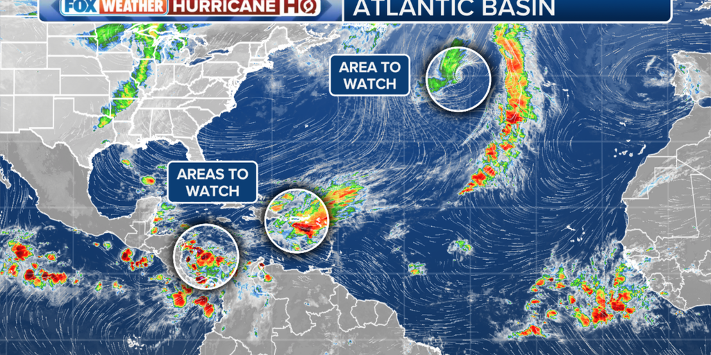
Another named storm is not out of the question as the final month of the 2024 Atlantic hurricane season begins Friday, and the National Hurricane Center is tracking three areas for potential development.
Nov. 30 marks the end of the Atlantic hurricane season, and that can't come soon enough. In the meantime, there are three areas worth watching as we count down the days.
The area with the most chance of development over the next week is in the southwestern Caribbean Sea. The NHC said some gradual development is possible over the next two days, and a tropical depression could form over the weekend or early next week as the area of low pressure moves in a northern-northwestern direction. As of the latest advisory, the NHC is giving this area a medium chance of development in the next week.
BRYAN NORCROSS: FORECAST CONSENSUS SHOWS A TROPICAL SYSTEM TRACKING TOWARD THE GULF NEXT WEEK
The next name on the 2024 Atlantic list is Patty.
The NHC said even without becoming a cyclone, the system will bring locally heavy rains across parts of Central America.
The NHC is also monitoring an area of low pressure in the northeastern Caribbean Sea, but this system has a low chance of developing over the next week. It's likely to become absorbed in the first area to watch in the southwest Caribbean Sea.
HOW TO WATCH FOX WEATHER
In the North Atlantic, the NHC is watching an area of showers and thunderstorms near the center of a low-pressure area about 550 miles west of the Azores. Any tropical development is expected to be slow as the system moves east over the next few days.
This area has a low chance of development over the next week.
Comments( 0 )
0 0 0
0 0 3

:quality(70)/cloudfront-us-east-1.images.arcpublishing.com/adn/JF6FH7DLYVBLZMKLMUUM52A2CI.JPG)


