Storm nearing Carolinas threatens area with up to 10 inches of rain, possible flooding
Posted on 09/16/2024

North and South Carolina are bracing for heavy wind, rain, potential floods and tornadoes as a Potential Tropical Storm Eight arrives on Monday.
As of Monday morning, the "low-pressure system" did not yet classify as a tropical storm, the National Hurricane Center said, but it picked up some strength on its path northwest toward South Carolina's coast at 3 mph. At around 100 miles east of Charleston, it carried maximum sustained winds of 50 mph.
The storm is expected to make landfall in South Carolina on Monday afternoon and travel across both states overnight through Wednesday, the hurricane center said in an advisory on Monday morning.
If it becomes a tropical storm, it will be named Helene – the next name on the list. The chances of that have lessened as the storm's structure became less organized in the early hours of Monday, and its maximum winds are expected to slow down as it approaches the coast, forecasters say.
A tropical storm warning was in effect for a large swath of both states on Monday morning, with the area expected to see "gusty winds, heavy rains, and coastal flooding," according to the National Hurricane Center. Those areas could still see tropical-storm-force winds.
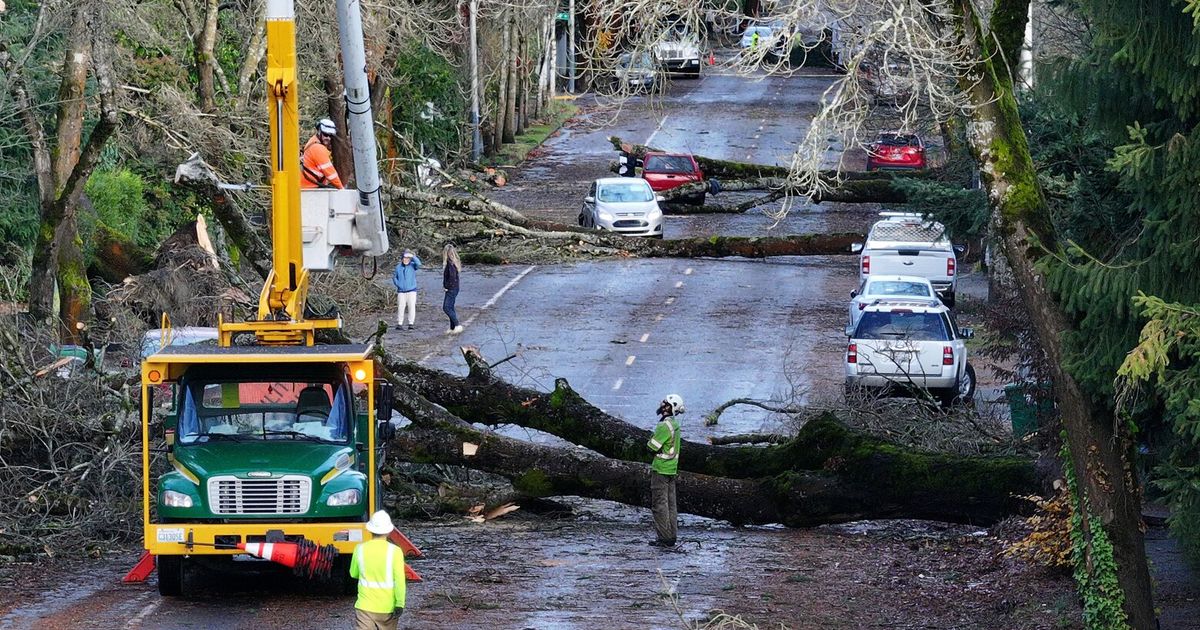
The storm is expected to drench the hardest-hit area in up to 8 inches of rain, while some areas could see as much as 10 inches of rain, according to the advisory. "A couple" tornadoes could also spin up in the eastern parts of both states through Monday night, the center said.
The rainfall could trigger "locally considerable flash and urban flooding" in the Carolinas, and put the entire Mid-Atlantic region at risk of isolated floods, according to the advisory. Rivers in southeastern North Carolina and northeastern South Carolina could also experience minor flooding through Monday night.
More:Tropical storm tracker: Cyclone in Atlantic could hit Carolinas Monday
Latest developments:
∎ The National Hurricane Center said the storm is expected to gain little strength before it makes landfall. It will weaken further as it moves inland until it dissipates on Wednesday, forecasters said.
∎ Elevated tides associated with the full moon, large swells, and strong northeast winds are forecast to cause high tides along the coast leading to minor or moderate coastal flooding through early in the week, the weather service said. Additional storm development could also further increase the risk of more significant coastal flooding.
∎ Gordon lost ferocity out in the Atlantic and weakened to a tropical depression by 5 p.m., according to the National Hurricane Center. Gordon posed no threat to land, the weather service added.
More:Firefighters make progress in battling Southern California wildfires amid cooler weather
Some North Carolina schools close due to weather
With the potential for tropical storm conditions on Monday, some schools in North Carolina will not open.
Brunswick County Schools posted on Facebook on Monday morning that students should stay home, while teachers have an optional workday.
Meanwhile, Brunswick Community College will also shutter its doors on Monday due to the severe weather. Classes will take place remotely where possible.
Schools in New Hanover and Pender will operate on a normal schedule.
-- Sherry Jones, Wilmington StarNews
Risk for swimmers on Outer Banks of North Carolina
The Outer Banks of North Carolina are known for currents that can be dangerous for swimmers. The new system heightened the risk, the weather service said in an update Sunday.
The good news: The most likely time for strong rip currents to occur Sunday was a couple of hours on either side of low tide, which took place before noon. Still, the risk of rip currents remained, and the update warned inexperienced swimmers to stay out of the water.
"Rip currents can sweep even the best swimmers away from shore into deeper water," the update warned. "Dangerous shore break can throw a swimmer or surfer head first into the bottom causing neck and back injuries."
Contributing: John Bacon and Thao Nguyen, USA TODAY
As of Monday morning, the "low-pressure system" did not yet classify as a tropical storm, the National Hurricane Center said, but it picked up some strength on its path northwest toward South Carolina's coast at 3 mph. At around 100 miles east of Charleston, it carried maximum sustained winds of 50 mph.
The storm is expected to make landfall in South Carolina on Monday afternoon and travel across both states overnight through Wednesday, the hurricane center said in an advisory on Monday morning.
If it becomes a tropical storm, it will be named Helene – the next name on the list. The chances of that have lessened as the storm's structure became less organized in the early hours of Monday, and its maximum winds are expected to slow down as it approaches the coast, forecasters say.
A tropical storm warning was in effect for a large swath of both states on Monday morning, with the area expected to see "gusty winds, heavy rains, and coastal flooding," according to the National Hurricane Center. Those areas could still see tropical-storm-force winds.
The storm is expected to drench the hardest-hit area in up to 8 inches of rain, while some areas could see as much as 10 inches of rain, according to the advisory. "A couple" tornadoes could also spin up in the eastern parts of both states through Monday night, the center said.
The rainfall could trigger "locally considerable flash and urban flooding" in the Carolinas, and put the entire Mid-Atlantic region at risk of isolated floods, according to the advisory. Rivers in southeastern North Carolina and northeastern South Carolina could also experience minor flooding through Monday night.
More:Tropical storm tracker: Cyclone in Atlantic could hit Carolinas Monday
Latest developments:
∎ The National Hurricane Center said the storm is expected to gain little strength before it makes landfall. It will weaken further as it moves inland until it dissipates on Wednesday, forecasters said.
∎ Elevated tides associated with the full moon, large swells, and strong northeast winds are forecast to cause high tides along the coast leading to minor or moderate coastal flooding through early in the week, the weather service said. Additional storm development could also further increase the risk of more significant coastal flooding.
∎ Gordon lost ferocity out in the Atlantic and weakened to a tropical depression by 5 p.m., according to the National Hurricane Center. Gordon posed no threat to land, the weather service added.
More:Firefighters make progress in battling Southern California wildfires amid cooler weather
Some North Carolina schools close due to weather
With the potential for tropical storm conditions on Monday, some schools in North Carolina will not open.
Brunswick County Schools posted on Facebook on Monday morning that students should stay home, while teachers have an optional workday.
Meanwhile, Brunswick Community College will also shutter its doors on Monday due to the severe weather. Classes will take place remotely where possible.
Schools in New Hanover and Pender will operate on a normal schedule.
-- Sherry Jones, Wilmington StarNews
Risk for swimmers on Outer Banks of North Carolina
The Outer Banks of North Carolina are known for currents that can be dangerous for swimmers. The new system heightened the risk, the weather service said in an update Sunday.
The good news: The most likely time for strong rip currents to occur Sunday was a couple of hours on either side of low tide, which took place before noon. Still, the risk of rip currents remained, and the update warned inexperienced swimmers to stay out of the water.
"Rip currents can sweep even the best swimmers away from shore into deeper water," the update warned. "Dangerous shore break can throw a swimmer or surfer head first into the bottom causing neck and back injuries."
Contributing: John Bacon and Thao Nguyen, USA TODAY
Comments( 0 )

0 0 0


0 0 2