Tropical Storm Milton Is Expected to Bring Heavy Rain to Florida
Posted on 10/05/2024

“So in some ways, it’s been busy, and in some ways, it hasn’t been busy,” said Matthew Rosencrans, the lead forecaster for the National Oceanic and Atmospheric Administration’s seasonal hurricane outlook. His organization was one of many this spring that predicted an abnormally busy season.
In May, NOAA said it expected 17 to 25 named tropical cyclones, eight to 13 of which would become hurricanes. An updated assessment in August, issued during a long lull in storms, held generally the same forecast. There have been 13 named storms this year, and eight have become hurricanes. The latest, Tropical Storm Milton, formed on Saturday in the Gulf of Mexico, and forecasters warned that it, too, could become a hurricane by the time it reaches Florida next week.
October and November typically calm down slightly. When graphed, an average season looks like a tall mountain with a solid peak of activity at the beginning of September. But seasonal hurricane experts like Phil Klotzbach at Colorado State University believe this year will instead bring three hurricane seasons: “A busy start, a super-quiet peak and a busy finish,” he said. When graphed, this season will look like two mountain peaks with a distinct valley in the center.
In early July, Hurricane Beryl, the earliest major hurricane to form in a season, was the first hurricane to land in the United States, lashing Houston with damaging winds and bringing warnings of what was to come this season. Then came Debby, which flooded Florida, Georgia and the Carolina coasts in early August. Then, after Hurricane Ernesto, the Atlantic went quiet. There was nothing for weeks at what was supposed to be the height of the season. Forecasters who had warned of the worst began questioning their expectations and looking for explanations for the lull.
Scientists are already trying to diagnose what happened, in hopes of informing future forecasts and better preparing coastal residents. One possible explanation is that the African Monsoon, a weather pattern that can spin up storms off Africa’s west coast, was too far north. Instead of moving over warm tropical water, this year’s storms hit cooler conditions that were less conducive to helping them form. Another hypothesis is that the air was too warm at higher levels, which meant that the already warmer air at the surface of the ocean couldn’t rise up to form thunderstorms.
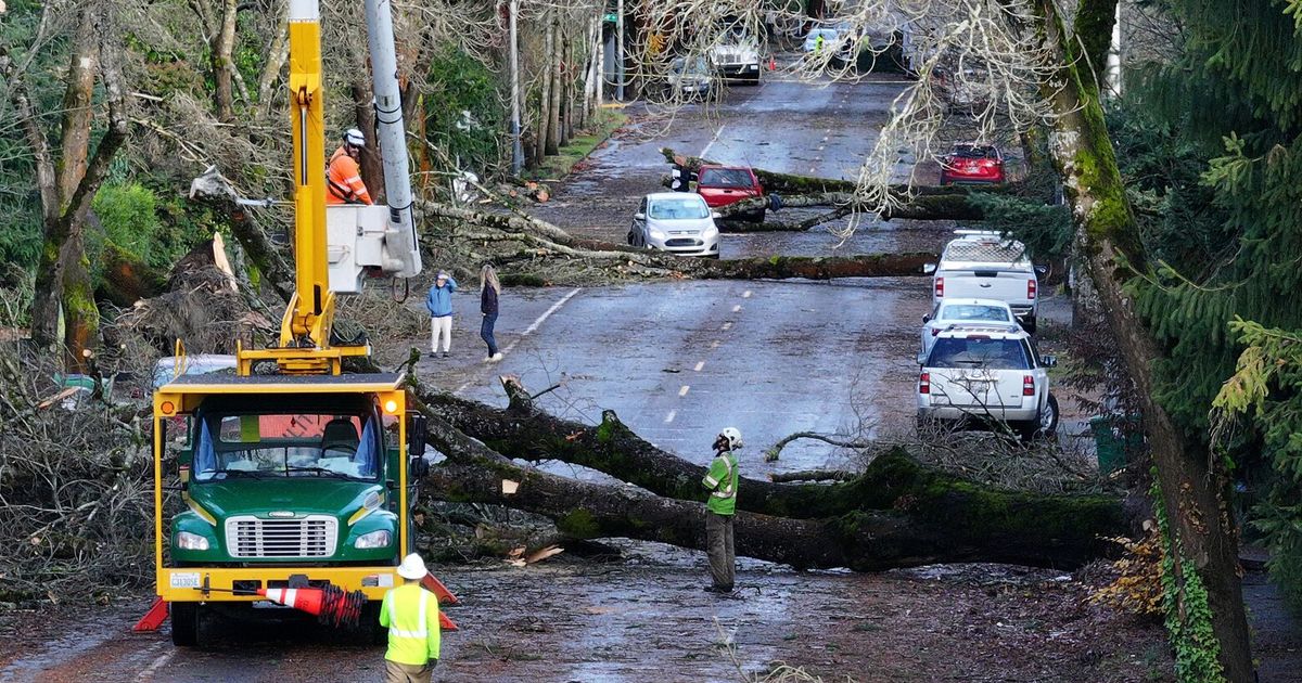
Then, almost overnight, just after the midpoint of hurricane season in mid-September, the lull broke. Francine formed and hit Louisiana, and not far behind it were more: Gordon, Kirk and Leslie, which churned generally harmlessly in the middle of the Atlantic. The worst was Helene last week, which rapidly intensified in the Gulf of Mexico, striking the Florida shores as the strongest hurricane to ever hit the state’s Big Bend coastline. Its tropical downpours dropped over two feet of rain on parts of the Appalachian Mountains, causing widespread destruction.
Despite the quick succession of recent storms, “we’re probably a little behind where I would have expected to be at the beginning of the season, given the outlook we had,” Mr. Rosencrans said.
When Leslie formed this week, the season officially became average, at least as far as the number of overall storms. But of the named storms, 66 percent have become hurricanes. So the average season may yet have an above-average number of hurricanes.
Even though the total storm count is likely to be lower than forecasters predicted in the spring, details this year have surprised them.
Historically, in October, a storm is much more likely to form in the Caribbean Sea or the Gulf of Mexico than in the eastern Atlantic. But Hurricane Kirk and Leslie, became a hurricane late Friday night, have done just that, forming off the coast of Africa and moving through Atlantic waters this week. Dr. Klotzbach called that “impressive.”
“The conditions that would make this an above-normal season, the warm sea surface temperatures, the coming of La Niña, are still in place,” Mr. Rosencrans said. An average year could produce three named storms in October and one in November. So another five or six storms are not out of the question, he added, and this would be close to the lower end of NOAA’s forecast of 17.
The hurricane season officially ends on Nov. 30. Still, Mr. Rosencrans cautions that during the La Niña years, with warm sea surface temperatures in the Atlantic, the active season can last into December. That happened in 2005 when Hurricane Epsilon formed in late November and stretched into the first week of December and then Tropical Storm Zeta formed at the end of the year, lasting into the first week of 2006.
“We’re realizing more than ever how deadly inland flooding is,” said Carl Schreck, a hurricane researcher at North Carolina State University, who was in his home near Asheville, N.C., when Helene struck.
Before a hurricane hits, news headlines usually highlight the category of a storm and its wind speeds, he said. But after the storm hits, the headlines tend to be about the rain.
That familiar five-point category rating, known to experts as the Saffir-Simpson scale, is the main way that the public understands a hurricane’s strength.
But the category rating is based only on wind speeds. It leaves out all of the other ways hurricanes can do damage, like storm surges, tornadoes and rain-caused flooding.
These other dangers can be more deadly than wind: Of 455 deaths directly caused by hurricanes from 2013 to 2023, 12 percent were caused by wind and 11 percent by storm surges (where wind pushes seawater toward the shore).
But 55 percent — 252 deaths — were caused by flooding due to rain, according to the National Hurricane Center.
As the climate warms, Americans can expect to see wetter, stronger and slower-moving storms that may be more likely to intrude farther inland. Inland populations are also generally poorer and less likely to have flood insurance compared with their coastal counterparts.
Yet there is no simple, widely used numerical scale to communicate a hurricane’s potential to cause flooding, as there is to communicate its wind speed.
Some scientists have developed new metrics to try to capture a hurricane’s rain risk. But Mr. Schreck, who recently developed one such measure, said the National Hurricane Center understandably does not want to confuse the public with multiple rating scales.
Experts still hope to grow public awareness beyond the category rating. “We need to rethink how we name, categorize and talk about these things because too many people are dying,” said Kathie Dello, the state climatologist of North Carolina.
When it comes to big storms, “I never think about the category,” she said.
Hurricane Florence — one of the wettest and most destructive hurricanes to hit North Carolina — made landfall as a Category 1. And Fred, a storm that caused record-breaking flooding in western North Carolina in 2021, was a tropical storm, not a hurricane.
Even “downgraded” to a tropical storm, Helene was still deadly: Its unusually large size meant that it took longer for the storm to pass overhead, and so it rained longer. As the mountain slopes drove the storm’s moisture upward, it condensed into even more rain that funneled down valleys, leading to record-breaking flooding.
Officials warned ahead of time about the risk of extreme rainfall and flash flooding. The National Oceanic and Atmospheric Administration put out a rare news release warning of “catastrophic, life-threatening inland flooding.” And the National Hurricane Center supplements its category scale with a lot more information about different hurricane hazards, including rainfall.
But in spite of all these warnings, the human toll remained catastrophic.
A storm by any other name
Around 10 days before Helene struck, a different tropical storm caused extensive flooding in southeastern North Carolina. That storm fell short of the wind speeds required of a hurricane. It didn’t receive an official name or a category rating, and was termed Potential Tropical Cyclone Eight.
“Not having a name was a problem,” said Ms. Dello, because it made it harder to communicate its risks to the public.
But the unnamed storm had severe effects. Some locations saw around 20 inches of rain. There were flash floods on Carolina Beach. Parts of Brunswick County saw extreme flooding that lasted for days. Some roads were washed out. One river had its second-highest levels on record, exceeded only by Hurricane Florence’s flood levels.
Weather experts have gotten much better over the years at forecasting major storms — hurricanes or not. But they can’t easily overcome how entrenched the hurricane category system is when it comes to the public’s sense of risk.
The National Weather Service does provide an excessive rainfall outlook, which predicts the risk of extreme rainfall in a given location with four ratings: marginal, slight, moderate and high risk.
The high risk ratings are issued on only about 16 days annually across the U.S., said Alex Lamers, who leads forecasting at the N.W.S.’s Weather Prediction Center. But those days account for 36 percent of the deaths and 80 percent of the damages caused by flooding in the U.S., he said.
“It’s about the strongest bell that we can ring,” he said.
For Helene, the Weather Service issued a high risk rating around Asheville about two days before the worst flooding started.
“It was a really remarkable forecast,” Ms. Dello said of the warning’s accuracy. But she said the forecast alone isn’t sufficient. To be more actionable, it needs to be translated into how much damage might happen on the ground — the threat to lives and infrastructure.
A false sense of security
Reports have referred to Helene as a “1 in 1,000 year storm.” This term is essentially a statistical estimate by NOAA based on past rainfall in a location. It’s used by city planners, engineers and floodplain managers to design for future floods.
But these estimates may provide a false sense of security. They are based on the past, and as the climate changes, the past becomes a poorer predictor of the future.
As a 2021 study in Europe found, climate change can increase the intensity of the most extreme flooding while also decreasing the intensity of moderate flooding. This means that recent historical experience may downplay the risk of what is to come.
In Asheville, a storm that occurs on average once in a thousand years is predicted to bring 11.4 inches of rain in three days. But during Helene, the airport’s weather station recorded nearly 14 inches of rain in that duration, according to the North Carolina State Climate Office.
The data that NOAA bases these predictions on is also out of date, Ms. Dello said. NOAA uses weather observations up to the year 2000 in most places, which leaves out over two decades of storms. And it does not account for climate change, which is expected to make extreme rainfall more common.
Updated rainfall estimates will be available starting in 2026, NOAA says, accounting for rainfall changes in a warming climate.
But even then, it will take a lot of work to make these risks easy for people to understand.
In May, NOAA said it expected 17 to 25 named tropical cyclones, eight to 13 of which would become hurricanes. An updated assessment in August, issued during a long lull in storms, held generally the same forecast. There have been 13 named storms this year, and eight have become hurricanes. The latest, Tropical Storm Milton, formed on Saturday in the Gulf of Mexico, and forecasters warned that it, too, could become a hurricane by the time it reaches Florida next week.
October and November typically calm down slightly. When graphed, an average season looks like a tall mountain with a solid peak of activity at the beginning of September. But seasonal hurricane experts like Phil Klotzbach at Colorado State University believe this year will instead bring three hurricane seasons: “A busy start, a super-quiet peak and a busy finish,” he said. When graphed, this season will look like two mountain peaks with a distinct valley in the center.
In early July, Hurricane Beryl, the earliest major hurricane to form in a season, was the first hurricane to land in the United States, lashing Houston with damaging winds and bringing warnings of what was to come this season. Then came Debby, which flooded Florida, Georgia and the Carolina coasts in early August. Then, after Hurricane Ernesto, the Atlantic went quiet. There was nothing for weeks at what was supposed to be the height of the season. Forecasters who had warned of the worst began questioning their expectations and looking for explanations for the lull.
Scientists are already trying to diagnose what happened, in hopes of informing future forecasts and better preparing coastal residents. One possible explanation is that the African Monsoon, a weather pattern that can spin up storms off Africa’s west coast, was too far north. Instead of moving over warm tropical water, this year’s storms hit cooler conditions that were less conducive to helping them form. Another hypothesis is that the air was too warm at higher levels, which meant that the already warmer air at the surface of the ocean couldn’t rise up to form thunderstorms.
Then, almost overnight, just after the midpoint of hurricane season in mid-September, the lull broke. Francine formed and hit Louisiana, and not far behind it were more: Gordon, Kirk and Leslie, which churned generally harmlessly in the middle of the Atlantic. The worst was Helene last week, which rapidly intensified in the Gulf of Mexico, striking the Florida shores as the strongest hurricane to ever hit the state’s Big Bend coastline. Its tropical downpours dropped over two feet of rain on parts of the Appalachian Mountains, causing widespread destruction.
Despite the quick succession of recent storms, “we’re probably a little behind where I would have expected to be at the beginning of the season, given the outlook we had,” Mr. Rosencrans said.
When Leslie formed this week, the season officially became average, at least as far as the number of overall storms. But of the named storms, 66 percent have become hurricanes. So the average season may yet have an above-average number of hurricanes.
Even though the total storm count is likely to be lower than forecasters predicted in the spring, details this year have surprised them.
Historically, in October, a storm is much more likely to form in the Caribbean Sea or the Gulf of Mexico than in the eastern Atlantic. But Hurricane Kirk and Leslie, became a hurricane late Friday night, have done just that, forming off the coast of Africa and moving through Atlantic waters this week. Dr. Klotzbach called that “impressive.”
“The conditions that would make this an above-normal season, the warm sea surface temperatures, the coming of La Niña, are still in place,” Mr. Rosencrans said. An average year could produce three named storms in October and one in November. So another five or six storms are not out of the question, he added, and this would be close to the lower end of NOAA’s forecast of 17.
The hurricane season officially ends on Nov. 30. Still, Mr. Rosencrans cautions that during the La Niña years, with warm sea surface temperatures in the Atlantic, the active season can last into December. That happened in 2005 when Hurricane Epsilon formed in late November and stretched into the first week of December and then Tropical Storm Zeta formed at the end of the year, lasting into the first week of 2006.
“We’re realizing more than ever how deadly inland flooding is,” said Carl Schreck, a hurricane researcher at North Carolina State University, who was in his home near Asheville, N.C., when Helene struck.
Before a hurricane hits, news headlines usually highlight the category of a storm and its wind speeds, he said. But after the storm hits, the headlines tend to be about the rain.
That familiar five-point category rating, known to experts as the Saffir-Simpson scale, is the main way that the public understands a hurricane’s strength.
But the category rating is based only on wind speeds. It leaves out all of the other ways hurricanes can do damage, like storm surges, tornadoes and rain-caused flooding.
These other dangers can be more deadly than wind: Of 455 deaths directly caused by hurricanes from 2013 to 2023, 12 percent were caused by wind and 11 percent by storm surges (where wind pushes seawater toward the shore).
But 55 percent — 252 deaths — were caused by flooding due to rain, according to the National Hurricane Center.
As the climate warms, Americans can expect to see wetter, stronger and slower-moving storms that may be more likely to intrude farther inland. Inland populations are also generally poorer and less likely to have flood insurance compared with their coastal counterparts.
Yet there is no simple, widely used numerical scale to communicate a hurricane’s potential to cause flooding, as there is to communicate its wind speed.
Some scientists have developed new metrics to try to capture a hurricane’s rain risk. But Mr. Schreck, who recently developed one such measure, said the National Hurricane Center understandably does not want to confuse the public with multiple rating scales.
Experts still hope to grow public awareness beyond the category rating. “We need to rethink how we name, categorize and talk about these things because too many people are dying,” said Kathie Dello, the state climatologist of North Carolina.
When it comes to big storms, “I never think about the category,” she said.
Hurricane Florence — one of the wettest and most destructive hurricanes to hit North Carolina — made landfall as a Category 1. And Fred, a storm that caused record-breaking flooding in western North Carolina in 2021, was a tropical storm, not a hurricane.
Even “downgraded” to a tropical storm, Helene was still deadly: Its unusually large size meant that it took longer for the storm to pass overhead, and so it rained longer. As the mountain slopes drove the storm’s moisture upward, it condensed into even more rain that funneled down valleys, leading to record-breaking flooding.
Officials warned ahead of time about the risk of extreme rainfall and flash flooding. The National Oceanic and Atmospheric Administration put out a rare news release warning of “catastrophic, life-threatening inland flooding.” And the National Hurricane Center supplements its category scale with a lot more information about different hurricane hazards, including rainfall.
But in spite of all these warnings, the human toll remained catastrophic.
A storm by any other name
Around 10 days before Helene struck, a different tropical storm caused extensive flooding in southeastern North Carolina. That storm fell short of the wind speeds required of a hurricane. It didn’t receive an official name or a category rating, and was termed Potential Tropical Cyclone Eight.
“Not having a name was a problem,” said Ms. Dello, because it made it harder to communicate its risks to the public.
But the unnamed storm had severe effects. Some locations saw around 20 inches of rain. There were flash floods on Carolina Beach. Parts of Brunswick County saw extreme flooding that lasted for days. Some roads were washed out. One river had its second-highest levels on record, exceeded only by Hurricane Florence’s flood levels.
Weather experts have gotten much better over the years at forecasting major storms — hurricanes or not. But they can’t easily overcome how entrenched the hurricane category system is when it comes to the public’s sense of risk.
The National Weather Service does provide an excessive rainfall outlook, which predicts the risk of extreme rainfall in a given location with four ratings: marginal, slight, moderate and high risk.
The high risk ratings are issued on only about 16 days annually across the U.S., said Alex Lamers, who leads forecasting at the N.W.S.’s Weather Prediction Center. But those days account for 36 percent of the deaths and 80 percent of the damages caused by flooding in the U.S., he said.
“It’s about the strongest bell that we can ring,” he said.
For Helene, the Weather Service issued a high risk rating around Asheville about two days before the worst flooding started.
“It was a really remarkable forecast,” Ms. Dello said of the warning’s accuracy. But she said the forecast alone isn’t sufficient. To be more actionable, it needs to be translated into how much damage might happen on the ground — the threat to lives and infrastructure.
A false sense of security
Reports have referred to Helene as a “1 in 1,000 year storm.” This term is essentially a statistical estimate by NOAA based on past rainfall in a location. It’s used by city planners, engineers and floodplain managers to design for future floods.
But these estimates may provide a false sense of security. They are based on the past, and as the climate changes, the past becomes a poorer predictor of the future.
As a 2021 study in Europe found, climate change can increase the intensity of the most extreme flooding while also decreasing the intensity of moderate flooding. This means that recent historical experience may downplay the risk of what is to come.
In Asheville, a storm that occurs on average once in a thousand years is predicted to bring 11.4 inches of rain in three days. But during Helene, the airport’s weather station recorded nearly 14 inches of rain in that duration, according to the North Carolina State Climate Office.
The data that NOAA bases these predictions on is also out of date, Ms. Dello said. NOAA uses weather observations up to the year 2000 in most places, which leaves out over two decades of storms. And it does not account for climate change, which is expected to make extreme rainfall more common.
Updated rainfall estimates will be available starting in 2026, NOAA says, accounting for rainfall changes in a warming climate.
But even then, it will take a lot of work to make these risks easy for people to understand.
Comments( 0 )

0 0 0


0 0 2